Corona lockdown has me like everybody else in the world. Unfortunately as of now, I can only sit at home and dream of being outside sailing. Nevertheless, I hope that you, dearest readers, are utilizing this ton of new spare time to educate yourself, maybe plan your next sailing trip or just dream away by consuming content. I used the time to dive deeper into the weather topic Why? You may have read my articles on the transfer of a Beneteau Oceanis 46.1 through Baltic, North and Mediterranean Sea in winter. A trip I found particularly demanding in terms of tackling the – let´s call it – special weather conditions.
“Special” in a sense that most of us are fair weather sailors, mostly enjoying our vacation in the favourite summer months. Especially the Adriatic sailing part of the Oceanis transfer was pretty impressive as this was my first time as skipper having to make decisions and deal with very strong winds and demanding sea conditions. As a team and a crew, we´ve done a pretty fine job in the end, which makes me proud. What I´ve learned is that I must learn much more about weather and trip planning: Just checking the usual digital suspects like Windy, Windfinder & Co just isn´t enough. First step for me was to buy a book that especially deals with the winds of the Mediterranean Sea. Here´s a condensate.
Basics of the Med

Like every ocean in the world the Mediterranean Sea is a place of which geographical conditions and properties are deciding details. It is a big sea for sure, but a compared to the Atlantic Ocean or the Pacific a very small area. Furthermore, the Med is confined by large land masses which are themselves subject to a complex and vivid weather system. The Med covers an area of 2.5 million square kilometres with a maximum North-South stretch of no more than 750 kilometres, mostly less. The Med has an average depth of 1.500 metres but can reach significantly deeper, such as 5.085 metres near Greece or 3.800 metres in the Thyrrenic Sea. Which brings us to the general areas of the med.
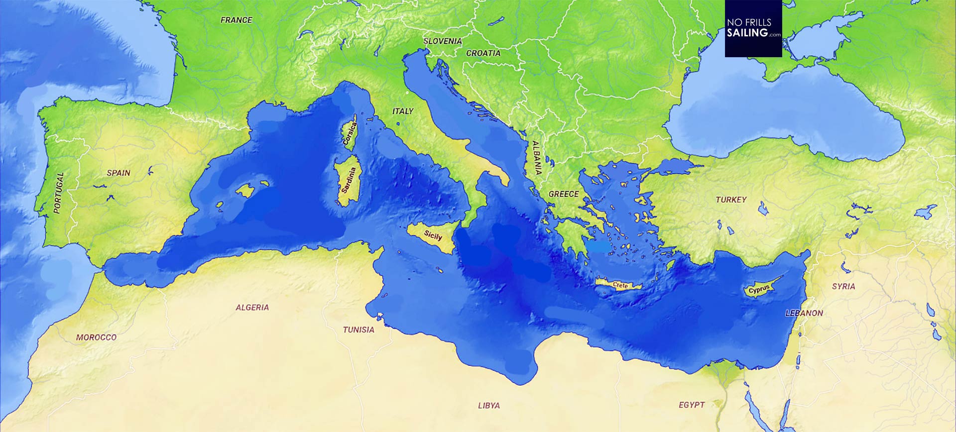
Looking at the map, one can clearly differentiate between the large western part of the Mediterranean with the very famous sailing areas around the Balearic Islands, the Gulfs of Genoa and Lyon, the Islands of Sardegna and Corsica – called the Thyrrenic Sea. In the East, divided by “boot” that is Italy, it´s the Adriatic and Ionian Seas in the North and the large, very famous Aegean Sea of Greece. Due to political turmoil both Levantine Sea, the area south of Crete and the Gulf of Sidra in the extreme East and South of the Eastern Med. Most sailing activity, as I mentioned, will be found in the Adriatic with Croatia as the prime spot for charter tourism – that is why this article will later focus on the Bora.
The main seasonal winds of the Mediterranean
Of course, the Bora is just one of a dozen seasonal winds in the Med. Western human culture is predominantly shaped by the Phoenecian, Greek and Roman seafaring civilizations. The Mediterranean has always been a busy place bristling with fishermen, short route traders and long haul merchant shippers, transporting all sorts of goods all though the Med and passing the Strait of Gibraltar even up North to Britain and Northern Europe. Generations of seafarer have lived with the winds and so it´s no wonder that the names derive from the Gods they believed in.

The winds, be it the Tramontana, the feared Bora, the Levantine, the famous Mistral or the hot African Scirocco are all seasonal winds, most of them active during wintertime. Only of few of them will blow in summer. Nearly all of these winds are restricted to certain areas of the Mediterranean Sea although the mechanics of high- and low-pressure systems causing these winds to appear may be the same for all. It´s always the compensating efforts of nature of finding a balance between high pressure and low pressure air masses – which derive their power from vaporized water, e.g. potential energy – that drives these systems. In the end, it´s the special geography of the land masses surrounding the Mediterranean Sea, the Alps, Pyrenees, the French Massif Central or the mountains of the Balkans that accelerates and channels these winds, sometimes turning them into pure fury.

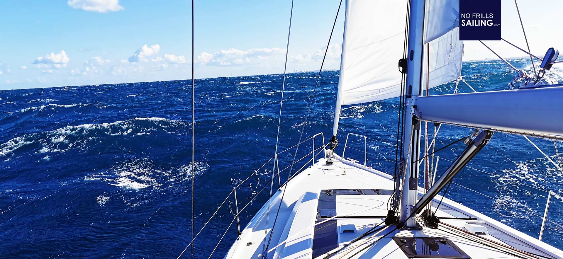
When we sailed on the Adriatic Sea some weeks ago and experienced the sheer force of a Bora it became very clear to me that as a skilled skipper it takes much more than just checking the weather apps. You have know about the area you are sailing in and have to have a general knowledge of the prevailing winds and sailing conditions that might be present during your time there. It´s just essential and adds considerably to your abilities as Captain, enabling you to make clear and knowledge-driven decisions. Here´s what I´ve learned from my three days strong wind-sailing in +35 knots of Bora.
The Bora: Adriatic´s Breath of the North
Croatia has a very, very rich and nice coastline boasting hundreds of beautiful islands. It is THE hot spot of European charter business and thousands of boats are swarming the coastal areas on a weekly basis. Nevertheless, there´s still more than enough room for each crew to have a great sailing week, finding anchor spots or picturesque fishing towns to land your boat. One thing have all these crews in common: They speak in awe of the mighty Bora.
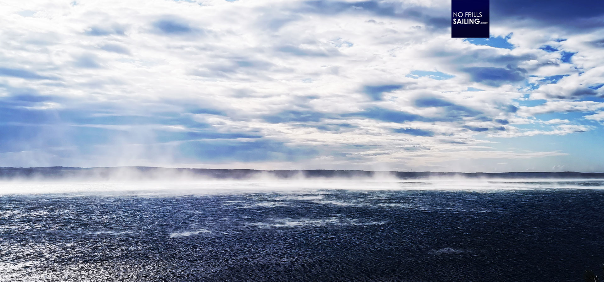
I´ve had the pleasure to experience the Bora two times whilst on dry land before getting to know her full force when out at sea. The Bora is a very cold, frosty wind that literally plummets down with sheer force. When the Bora is active (which can last for days) winds can reach up to 70 knots. The nature of the “falling” winds in addition to the very rapid, violent gusts makes it very dangerous to be surprised by it. It can rip apart the sails of a boat and can cause a yacht to heel dangerously when not reefed (or under engine). There is no long-term prediction for a Bora, it´s merely a matter of minutes or best hours before it strikes. Best sign is a thin but massive white cloud that is flowing over the mountains, signaling that cold air is now rushing down the mountainside and will hit hard next. In a greater picture, there are some constellations which can lead to a Bora.

That said, a skipper in the Adriatic should check isobaric weather charts and look out for a rapid moving low-pressure system passing Central Europe situated somewhere near the Black Sea. If then a (mere static) high pressure system in the Western Med around the Balearic Islands is present as well, there is a big chance that both the flow of the air masses and the special geographical profile of the Balkans will channel cold, dry air from the North down South – like a racing track these masses of air will be accelerated and create what we call the Bora.
Skipper´s Skills: Trip Planning & Weather Routing
When I planned the Adriatic sailing trip I made the mistake – driven by the rush of the moment and the fact that we didn´t had enough time for proper weather routing – that I relied solely on internet-bases weather information. Don´t get me wrong here: Windy, Windfinder & Co are good sources. But they have their limits. These apps just deliver a general picture and are not very up-to-date. We experienced differences in both timing (When will a wind set in?) of more than five hours of predicted weather changes and in intensity (How strong will a wind blow?) of more than 10 knots TWS. This is massive! I´ve learned that checking isobaric charts and drawing my own conclusions must be a first step of weather routing.

Secondly, derived from interpreting isobaric charts, a rough and very raw self-made weather forecast should be fabricated as a next step. This enables the skipper to acquire a general sense of the current weather situation of the whole continent which is very important – remember, for Europe, even for sailing in the Med, the Azores anticyclone and passing Atlantic low pressure systems can setting the tone how we are sailing in Greece. It´s essential. Only then a check of local weather forecasts is advised as these will enrich the big picture. Basic knowledge of the fundamental seasonal winds are a matter of course. Check your local book store for those books, it´s absolutely essential for a skilled skipper.
You might also find interesting to read:
Weather routing software and how to utilize it
Old fashioned trip planning
Offshore sailing, what I´ve learned